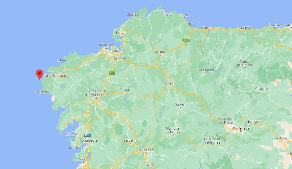
Cape Fisterra is often considered the westernmost point of the peninsula and therefore of continental Europe. However, it is only for history and legend, since geographically we find up to three more western capes. The westernmost would be Cabo da Roca in Portugal, followed by the one in question, Cabo Touriñán, located in Muxía. Even Cabo da Nave, very close to Finisterre, is located further west. Therefore we consider that of Touriñán as the westernmost point of Galicia and therefore of Spain.
Cabo Touriñán is an inhospitable cape, in a place with extreme weather, strong winds and heavy storms that make life very hard. That is why it is understandable that A Costa da Morte is a coast with little population and where we can still find numerous virgin places.
Some historians locate here the mythical and legendary Promontorium Nerium that others locate in the same Finisterre. In the same cape there is a small island known as Illa Herboso, Illa do Castillo or A Insúa where there are various archaeological remains.
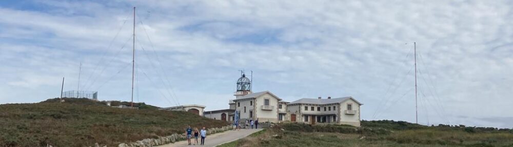
To facilitate the trip and guide the ships that transited near the dangerous Costa da Morte, which took so many lives, a small lighthouse was built in 1898 in Cabo Touriñán that is still preserved on the old building today. It was a white light created by the incandescence of paraffin and had a range of 10 miles. In 1918 the facilities were improved, doubling the miles of range.
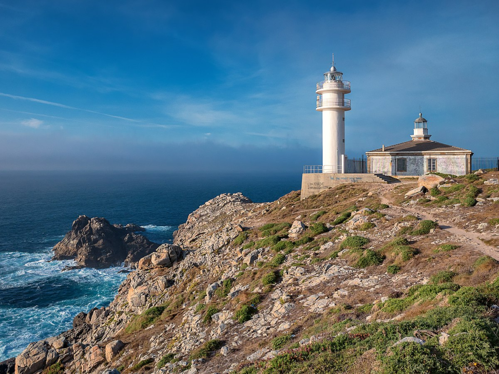
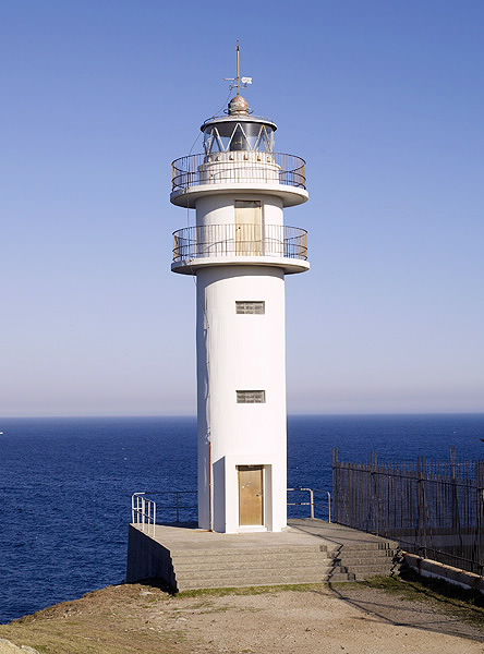
In 1981 the new lighthouse was erected which is 3 meters in diameter, 11 meters high and has a light range of 20 miles (37 km). This produces 1 and 2 flashes every 15 seconds. The mound that houses the lighthouse is 61 m above sea level.
About 300 meters inland from the sea is a very dangerous rocky place for sailors known as A Laxe de Buxeirados. Low scrub abounds in the area, typical of extreme coastal climates. It is common to see cattle grazed in freedom, especially horses.
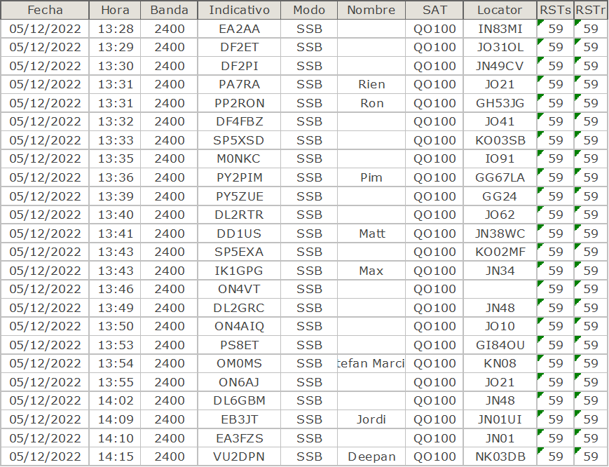
QO-100 ACTIVATION 05-12-2022
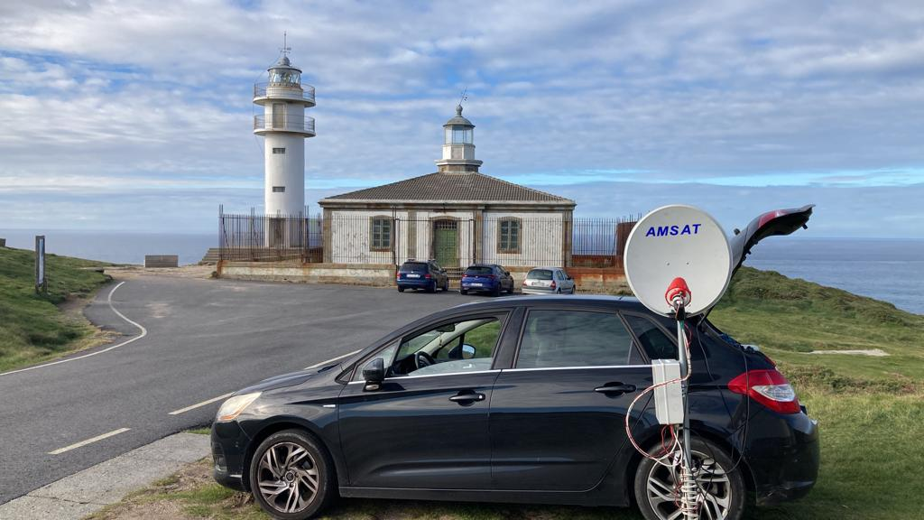
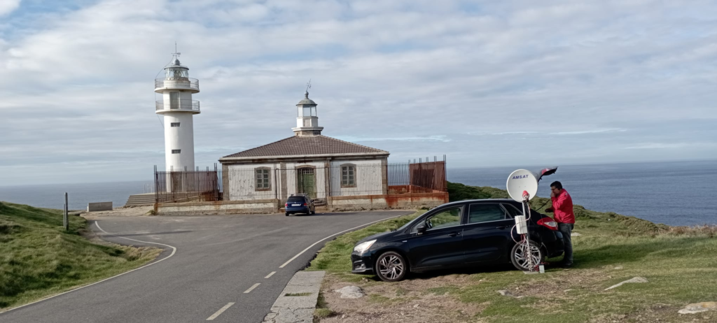
DATA OF LIGHTHOUSE
International Code: D- 1740
ARHLS Code:  SPA-049
Height above or ground: 14 meters
Focal Height: 65 meters
Light characteristic: 	L 0 2 oc 2 2 L 0 2 oc 6 1 L 0 2 oc 6 1
Range: 24 nautical miles
Grid Locator: IN53IB
Coordenates:  43°03′12″N 9°17′54″W