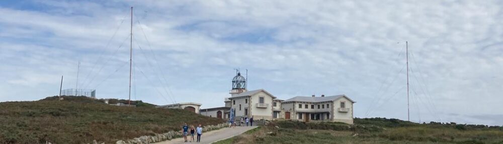
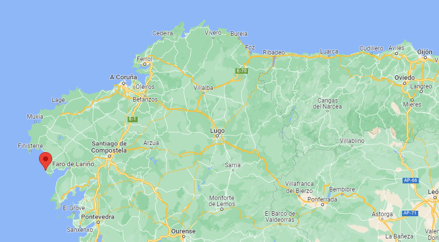
Located on the peninsula that separates the Corcubión and Muros-Noya estuaries, its construction is relatively modern, to link the Corrubedo and Finisterre lighthouses and mark a very dangerous area for navigation, full of shallows and reefs. For this reason its property is divided into several sectors that are identified differently. Its history dates back to 1904 when the need to quickly build a 4th order lighthouse in Punta Insúa was determined.
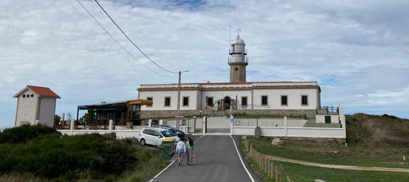
A year later it would be agreed that it would have the appearance of 2 + 2 white flashes and a minimum range of 7 miles. After carrying out a more complete study, in 1911 it was decided that the light should be fixed with four sectors, signaling the dangerous areas. In 1913 the construction of the lighthouse was completed. To achieve the appearance, a system of oscillating screens and a petroleum vapor incandescent lamp were designed. The exorbitant budget forced to change the characteristic, to attach a 3rd order optic removed from the Punta Grossa lighthouse in Ibiza. In 1921 the lighthouse was inaugurated, being electrified in 1947. This lighthouse is visible from the road that goes from Corcubión to the town of Muros. You can’t miss the fork: 3 km from Lira and 4 km before reaching Louro, a 600-m branch starts off that leads to the same lighthouse. This lighthouse is visible from the road that goes from Corcubión to the town of Muros. You can’t miss the fork: 3 km from Lira and 4 km before reaching Louro, a 600-m branch starts off that leads to the same lighthouse. This lighthouse is visible from the road that goes from Corcubión to the town of Muros. You can’t miss the fork: 3 km from Lira and 4 km before reaching Louro, a 600-m branch starts off that leads to the same lighthouse.
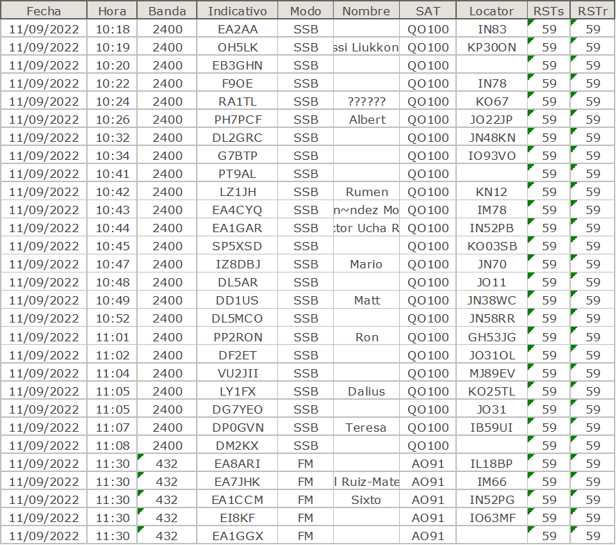
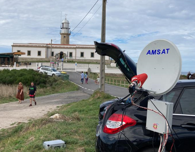
ACTIVATION QO-100 & AO91 11-09-2022
DATA OF LIGHTHOUSE
International Code: D-1782
ARLHS Code:  SPA-235
Description:
Height above or ground: 27 meters
Light characteristic:  L 0 5 oc 1 5 L 0 5 oc 1 5 L 0 5 oc 4 5
Rhythm of light: GpD(3)
Period: 9
Range: 15 nautical miles
Grid Locator: IN52ks
Coordenates: 42°46′21″N 9°07′30″O